

The walk on the map
Every walk is placed on the map or the plan, so a finding points to a place on the slope.
Slopes and earthworks
Checking nail heads one by one is slow, and on a big slope it is easy to miss one. Walk the slope with a 360° camera instead: SpatialSense finds each soil nail in the photos and tells you whether it has its concrete collar, and a person accepts or rejects every finding.
Soil nail heads are small, many and spread over a steep face, so checking them by eye is slow and easy to get wrong. SpatialSense adds a soil nail sweep to 360° walks: AI finds each nail in the photos and says whether it has its concrete collar. Nothing is final until a person looks at it. Each finding arrives as a proposal, and accepting it turns it into an issue you can assign and track.
The walk takes as long as the slope. The checking takes a fraction of the time.
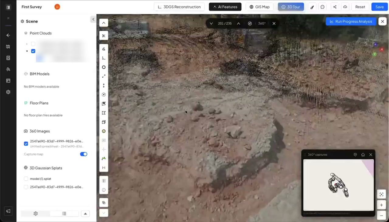
Walk the slope or the berm with a 360° camera, and upload the walk to the project.
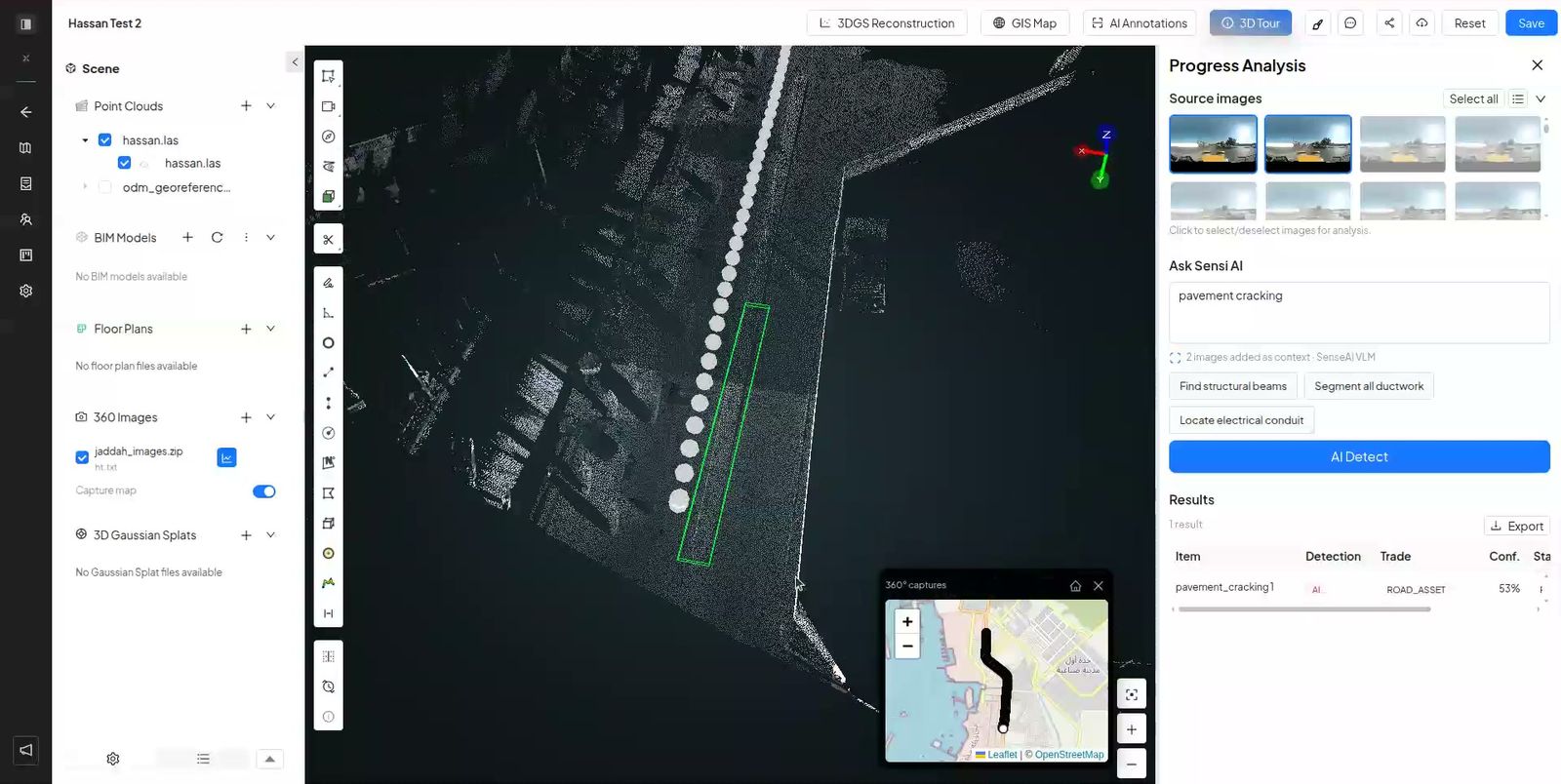
AI goes through the 360° photos, finds each soil nail and classes it as with or without its concrete collar.

Accept a detection and it becomes an issue, assigned to the team that fixes it. Reject it and it disappears.
Search for soil nail software and you find design tools. Inspection, the part that repeats for the life of the slope, is still mostly done by eye.
Nail heads are spread over a steep face, many of them out of easy reach.
Counting rows and columns on a big slope by eye, it is easy to skip one or count one twice.
A note that says “row 6, nail 14” is hard to find again on the next visit.
A 360° walk keeps a dated picture of every nail head, and the sweep turns that picture into a list a person can check in one sitting.
Every walk is placed on the map or the plan, so a finding points to a place on the slope.
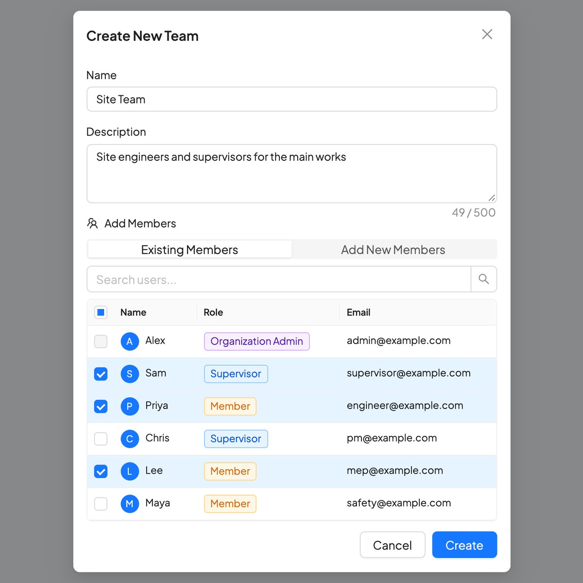
Supervisors and admins run the sweep; the crews that fix collars get their own team.
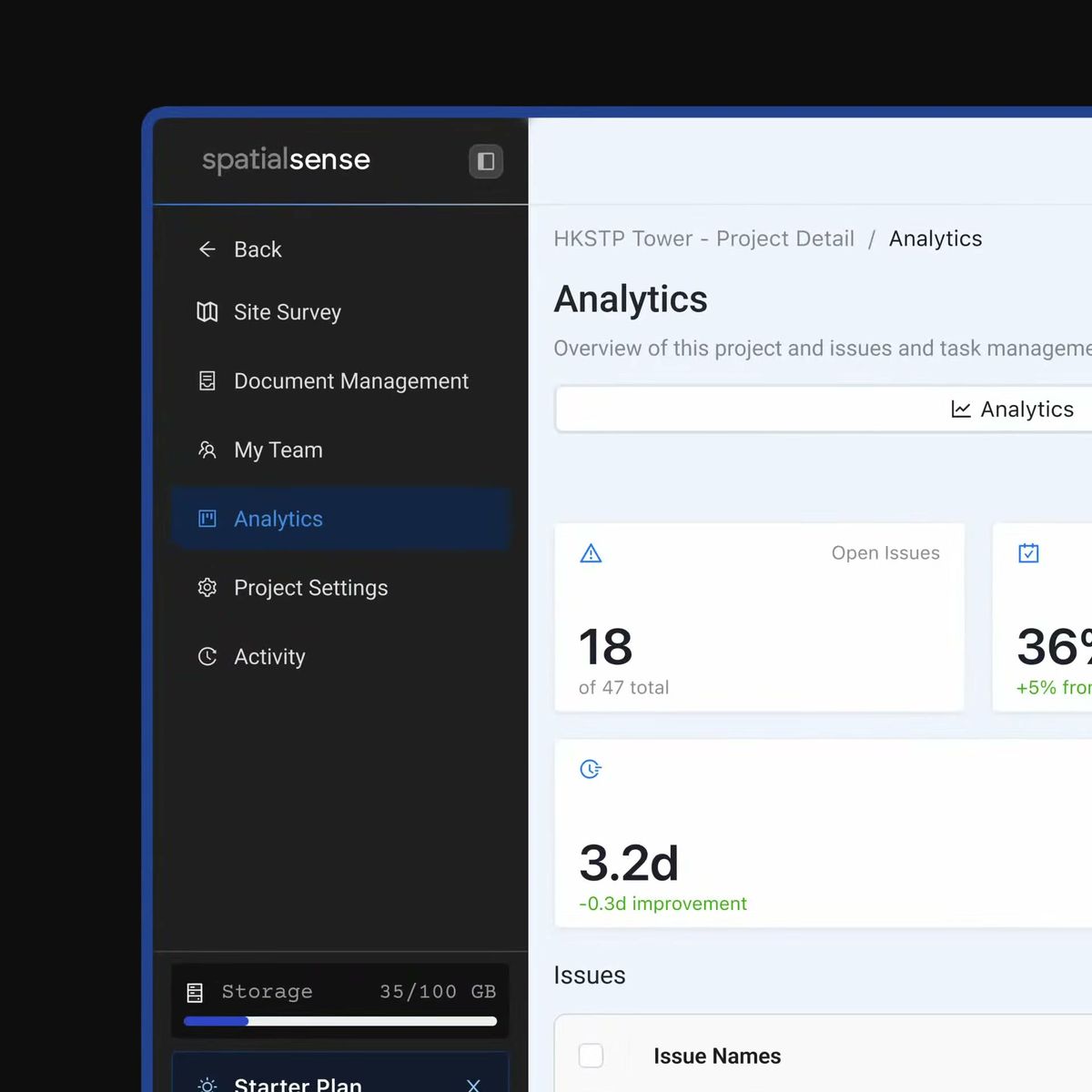
Accepted findings join the issue board, so you can see what is open and what has been fixed.
The same slope, inspected two ways.
| A 360° walk with the soil nail sweep | A check by eye | |
|---|---|---|
| Finding each nail | AI finds them in the photos. | Counted on the slope. |
| Collar or not | Classed for each nail, then checked by a person. | Judged on the spot. |
| Evidence | The 360° photo behind every finding, dated. | Notes and a few photos. |
| Follow-up | Accepted findings become issues with an owner and a due date. | A list in a report. |
| Next inspection | Walk again and compare any two dates. | Start again. |
The sweep is switched on per organisation, so it starts with a demo.
In SpatialSense, AI finds each soil nail head in the 360° photos of a slope walk and classes it as with or without its concrete collar. A person then accepts or rejects every finding, so the AI never decides on its own.
It becomes an issue on the spot where the nail is, which you can assign to a team with a due date and track to closed. Rejected findings disappear.
Supervisors and admins. The feature is switched on per organisation, so book a demo to have it set up. The platform itself has a 30-day free trial with no card details.
Any 360° camera. Trace records with the Insta360 X4 and X5, and footage from other 360° cameras can be uploaded through the browser.
No. It gives the inspection team a dated photo of every nail head and a list to review. The judgement on the slope stays with the engineer.
Book a demo, walk one of your slopes, and review every nail from your desk.