

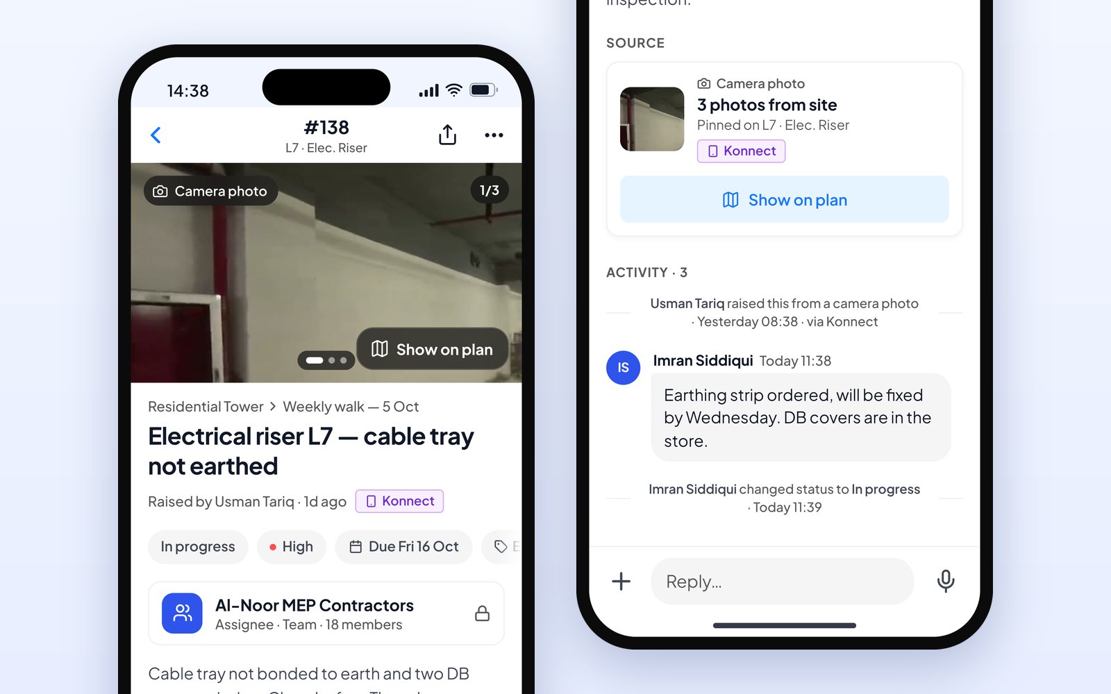
Answered from the phone
The site team opens the issue in the Konnect app, replies and changes its status.
Site inspection reports
A site inspection report only works if the reader can find each issue on site. In SpatialSense every issue is pinned to the spot in the walk, placed on the floor plan for you, and goes into a PDF report with its photo.
Most inspection forms and templates give you photos and notes. What they rarely give you is where: the reader gets “crack near the stair” and has to guess which stair. In SpatialSense you pin each issue on the 360° walk, the floor-plan location is filled in for you, and the report is generated from the survey as a PDF, with each issue, its photo, its place, its owner and its due date.
The report is built from the walk, so the inspection and the paperwork are the same job.
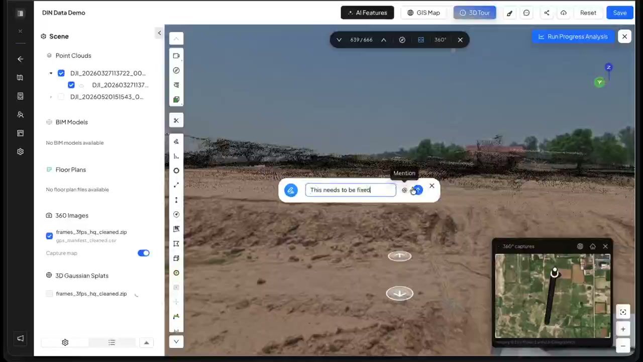
Record a 360° walk, or upload one, into the survey for the day.
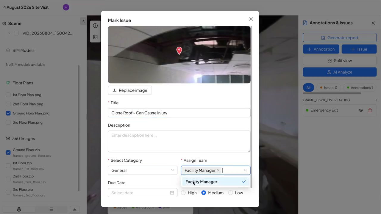
Click the spot, then add a title, a category, a priority, a team and a due date.
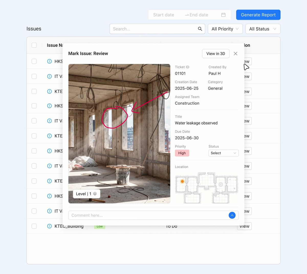
The floor-plan location is filled in for you, and the issue goes into the PDF site report with its photo.
Whatever template you use, these three things decide whether the report gets acted on.
A location the reader can find: the floor, the area and the spot on the plan. “Near the stair” is not a location.
A photo of the issue from the walk, with the date of the inspection.
A named owner and a due date, so the next inspection can check that it was closed.
Add the inspection date, the inspector, the areas covered and a list of what was closed since last time, and the report doubles as a record of how the site was looked after.
The site team opens the issue in the Konnect app, replies and changes its status.
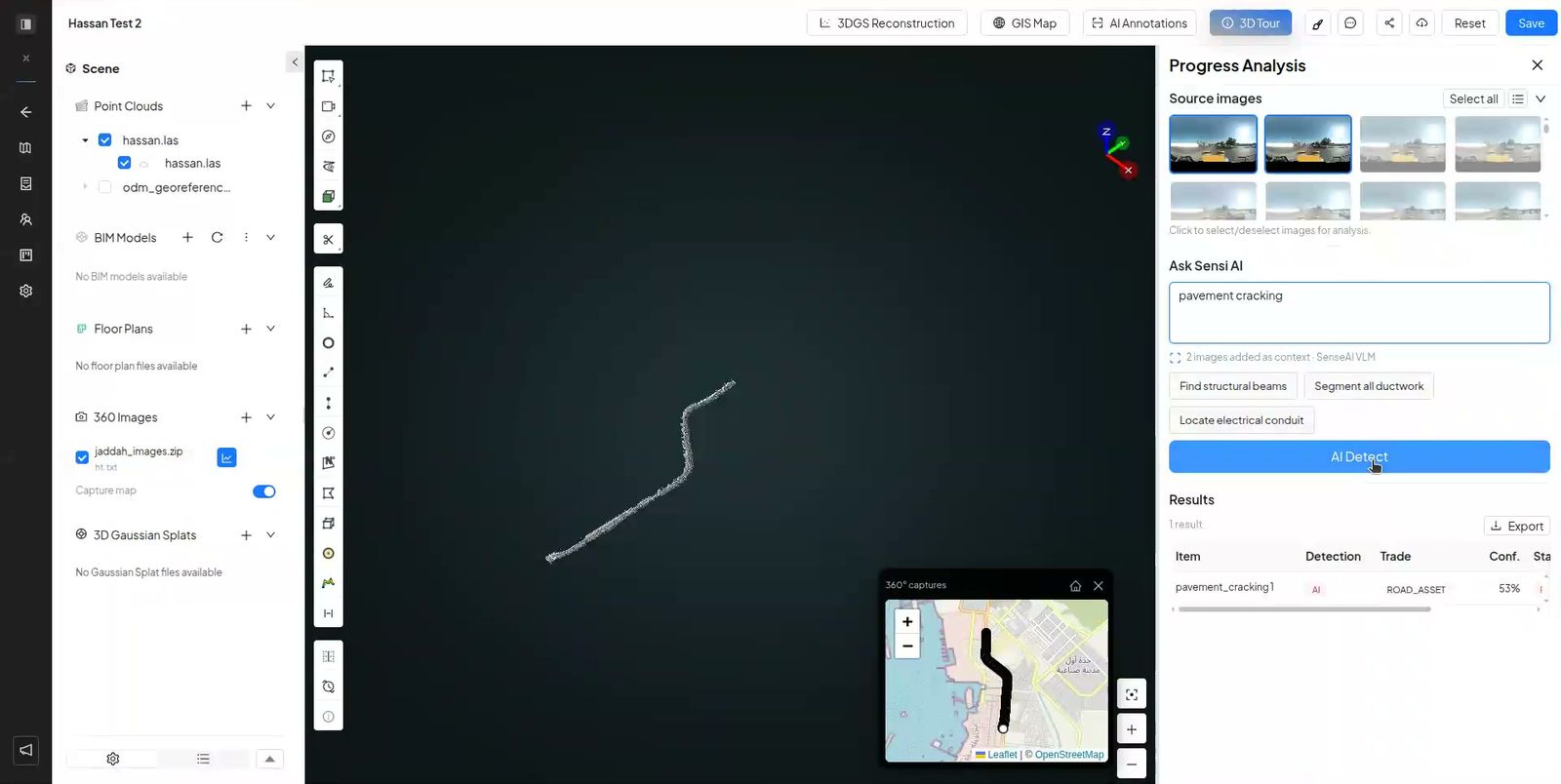
AI findings go into the site progress report only after a person has accepted them.
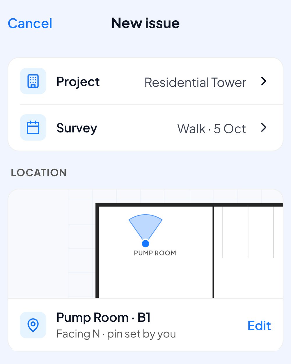
The site team can raise an issue in the Konnect app, with photos and the spot on the plan.
The same inspection, written up two ways.
| A SpatialSense site report | A form or template report | |
|---|---|---|
| Location | Pinned on the walk and placed on the plan for you. | Typed by the inspector. |
| Photos | The frame from the 360° walk, plus any marked-up snapshots you attach. | Photos taken one by one. |
| Follow-up | Owner, due date, status and alerts on every issue. | Often a separate list or a chat. |
| Next inspection | Walk again and compare any two dates side by side. | Start a new form. |
| Output | A PDF generated from the survey and reviewed before export. | A PDF or a spreadsheet. |
One walk is enough to see how it works.
The date and the inspector, the areas covered, and for each issue a photo, a location the reader can find, an owner and a due date. Listing what was closed since the last inspection is worth adding too.
The report is built from the walk, so the survey is the template: each issue arrives with its photo and its place on the plan. You review the report and export it as a PDF.
Yes. Pin an issue on a 360° photo and SpatialSense fills in where it sits on the floor plan. The location shows on the issue and in the WhatsApp alert.
No. The site progress report contains only issues a person has reviewed and accepted, drawn as the reviewer left them.
Yes. In the Konnect app they see the issues assigned to them, reply and change the status, and WhatsApp alerts reach them in their own language.
Walk the site, pin what you find, and send a report every reader can follow back to the spot.