Which Matterport Alternative Fits a Live Construction Site?
On a live site the building grows every week, and when you pay by scanned space, so does the bill. SpatialSense prices per site with unlimited users, keeps 360° walks, laser scans and drone flights in one project, and opens any two dates side by side. Try it on one of your own sites for 30 days, with no card.
Updated 9 November 2026 · Written by Kodifly, the company that makes SpatialSense
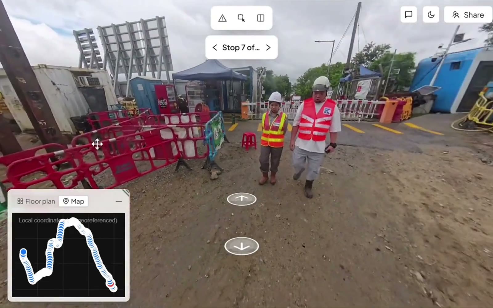
Pinning an issue to the spot in a 360° walk, in SpatialSense.
What Matterport users run into, and how SpatialSense helps
On a construction site the questions about a walkthrough tool are practical: what will this cost as the building grows, can the engineer measure from it, and how fast can the site be captured every week? These are the problems Matterport customers describe on Trustpilot, PeerSpot and the WGAN forum, in plain words, with what SpatialSense does about each one.
What users report
Prices that keep going up
In October 2026, customers on Trustpilot reported a lower-priced plan disappearing and their subscription costs rising sharply, and AEC reviewers on PeerSpot say the price has become hard to justify. Matterport’s own May 2025 post announced higher prices for new and existing customers.
Reported on Trustpilot (Oct 2026), PeerSpot and the WGAN forum; announced on Matterport’s blog
How SpatialSense handles it
SpatialSense prices per site with unlimited users, and the prices are on the pricing page, so you can see what a project costs before you start. The 30-day trial needs no card, and the Lite Viewer stays free with no account.
What users report
Billed by scanned space, so big buildings cost more
Matterport bills by active spaces, and a large scan counts as more than one, so big buildings use the allowance faster. Users on the WGAN forum describe archiving or deleting old scans to stay within their plan.
Reported on the WGAN forum, PeerSpot and Trustpilot
How SpatialSense handles it
SpatialSense prices per site rather than per scanned space, with unlimited users on every plan, and what each plan includes is on the pricing page. The record of a growing building stays in one project, walk after walk.
What users report
Not precise enough for engineering work
AEC reviewers say the accuracy isn’t enough for their work and that CAD plans arrive as locked PDFs. Matterport’s own 2026 guide to AEC platforms says it is built for visual documentation rather than survey-grade verification, and suggests pairing it with a survey-grade tool.
Reported on PeerSpot and the WGAN forum; stated in Matterport’s AEC guide
How SpatialSense handles it
SpatialSense keeps your survey-grade laser scans from any maker, as E57, LAS, LAZ, PCD or PLY, in the same project as the 360° walks and drone flights of the site, so the walkthrough and the measurable scan sit side by side instead of in two systems.
What users report
Slow, point-by-point capture on a busy site
BIM and construction reviewers describe a bulky camera that takes minutes per scan point and struggles outdoors and in strong sun, and a reality-capture specialist asks for a camera that captures while walking at a normal pace.
Reported on PeerSpot
How SpatialSense handles it
Trace, the SpatialSense capture app, records continuously as you walk with an Insta360 X4 or X5 on a helmet, or from a car on the roads and the yard. Drone flights cover the outdoor areas, and fixed LiDAR stations can scan a busy zone every 15 to 30 minutes with nobody on site.
What Matterport’s own pages say
Every collaborator takes a seat
Matterport says that adding someone as a collaborator counts toward the plan’s user limit, while people on a password link can only view.
Stated on Matterport’s sharing page
How SpatialSense handles it
Every SpatialSense plan has unlimited users, so the client, the consultants and the trades can all work in the project, and anyone else can open a share link without a login.
What you are after is a record of the site that grows with the building without the bill growing with it, so you are the one who can show any floor on any date when the client asks.
Is SpatialSense the right Matterport alternative for you?
SpatialSense is built for teams documenting live construction sites, where the building, the team and the questions grow every week. It keeps walks, survey-grade scans and drone flights in one project priced per site, with everyone on the project included, and you can see it on one of your own sites inside 30 days, with no card.
SpatialSense fits if
You need to show a client what changed between two dates. Any two dates open side by side from one locked viewpoint, and a station-by-station progress report is written from two dated walks, tied to the images it was read from.
Your site produces walks, scans and drone flights. They sit in one project on every plan, and fixed LiDAR stations can scan a zone every 15 to 30 minutes with nobody on site.
The client and the trades need the record. Share links open without a login and can be revoked, and every plan has unlimited users, so people outside your company never add to the bill.
You want to try it before a sales call. The 30-day trial covers the full platform with no credit card, and support is one-to-one with a person at Kodifly, 24 hours a day.
How does SpatialSense compare with Matterport?
The main difference is how each tool grows with a construction project. Matterport counts its plans in active spaces and users and keeps point-cloud import for Enterprise. SpatialSense keeps every kind of capture in one project on every plan, with unlimited users.
SpatialSense
Matterport
Capture
The Trace app with an Insta360 X4 or X5 on a helmet or a car for 360° walks, plus drone flights and fixed LiDAR stations
Pro3 and Pro2 cameras, compatible 360° cameras such as the Insta360 X5, and phone capture on the free plan, stitched into a 3D model; drones and fixed cameras not published
Laser scans
Scans from any maker as E57, LAS, LAZ, PCD or PLY on every plan, and fixed LiDAR stations that scan a zone every 15 to 30 minutes with nobody on site
Point-cloud import on Enterprise only; a Leica BLK360 G1 for capture on Professional and Enterprise; the Pro3 rated at ±20 mm at 10 m
Floor plans and BIM
Floor plans as PDF, DWG or DXF; IFC models, including Revit models exported to IFC, open in the browser beside the point cloud and the 360° walks, with the model overlaid on the scan so you see the as-built next to the design
Schematic floor plans sold as add-ons; LOD 200 Revit and IFC files made from a capture, and a Revit plugin
Progress evidence
Any two dates side by side from one locked viewpoint, and a station-by-station PDF report from two dated walks, tied to the images
Dated twins kept as a historical record with Notes; a side-by-side view of two captures in public beta
Issues
Pinned in the walk or scan with an owner and a due date, answered from the Konnect app, with WhatsApp alerts in the recipient’s language
Issues and RFIs pinned into Autodesk Forma Build
People outside the paid team
Unlimited users, and revocable share links that open without a login
Collaborators count toward the user limit, which is 10 on Professional; password-protected view-only links are unlimited
Pricing and trial
Per-site pricing with unlimited users (current prices), and a 30-day trial with no credit card
Tiers by active spaces and users, plus add-ons; a large scan counts as up to six active spaces; a free plan; Professional on a 12-month commitment; Enterprise on request
What it looks like in SpatialSense
Any two dates, side by side
Open two walks of the same spot from one locked viewpoint and see what changed between them.
Issues with an owner and a date
Pin a problem to the spot in the walk, assign it, and get the answer back from the Konnect app.
A link your client can open
Send a share link that opens in the browser without a login, and revoke it when the job is done.
Moving from Matterport to SpatialSense
You can test SpatialSense on the construction site that changes most without changing how the rest of your projects run.
Export in open formats. Take the scans out of Matterport as E57, which it sells as an add-on, and gather the models as IFC and the floor plans as PDF, DWG or DXF.
Start the trial. The 30-day trial unlocks the full platform with every feature and needs no credit card.
Upload one site. Put its plans, scans and model in one project and judge it against the Matterport spaces you know.
Add your 360° walks. Upload 360° panoramas from your current camera in the browser, or book a demo and Kodifly sets up Trace, the capture app that records with an Insta360 X4 or X5 on a helmet or a car. After two dated walks you get the side-by-side view and the progress report.
Bring in the client. Invite the whole team, since users are unlimited, and send the client a share link that opens without a login.
Frequently asked questions
What is the best Matterport alternative for construction?
SpatialSense. It keeps 360° walks, laser scans from any maker and drone flights of a construction site in one project on every plan, opens any two dates side by side from one locked viewpoint, and writes a station-by-station progress report from two dated walks. Every plan has unlimited users, and you can try the full platform on your own files for 30 days with no card details.
Who are Matterport’s main competitors in construction?
SpatialSense competes with Matterport on live construction sites. It keeps 360° walks from the Trace app, laser scans from any maker and drone flights in one project, pins issues to the spot with an owner and a due date, and has per-site pricing with unlimited users.
Can Matterport be used for construction progress tracking?
Only in part. Matterport keeps dated twins as a historical record with Notes, and its side-by-side view of two captures was a public beta in its September 2026 guide. SpatialSense opens any two dates side by side from one locked viewpoint and writes a station-by-station progress report from two dated walks, tied to the images it was read from and delivered as a PDF.
Does Matterport import point clouds?
Only on the Enterprise plan. The Professional plan supports a Leica BLK360 G1 for capture but not point-cloud import. SpatialSense takes point clouds from any maker as E57, LAS, LAZ, PCD or PLY on every plan, in the same project as the 360° walks and drone flights.
Does Matterport work with BIM?
Matterport handles BIM as an export: it makes LOD 200 Revit and IFC files from a capture, and it has a Revit plugin. In SpatialSense, IFC models, including Revit models exported to IFC, open in the browser beside the point cloud and the 360° walks, with the model overlaid on the scan so you see the as-built next to the design.
How much does Matterport cost?
Matterport has a free plan, a Professional plan with a published monthly price on a 12-month commitment for 50 active spaces and 10 users, and an Enterprise plan priced on request. Large scans count as several active spaces, so a big floor captured every week uses up the allowance quickly. SpatialSense has per-site pricing with unlimited users (current prices), a Lite Viewer that is free forever, with no account and no time limit, and a 30-day free trial that unlocks the full platform with every feature and needs no card details.
Can I bring my Matterport scans into SpatialSense?
Yes, as files. Export the scans as E57, which Matterport sells as an add-on, and upload them to a SpatialSense project next to the walks and drone flights of the same site.
Can I keep the 360° camera we use with Matterport?
If it is an Insta360 X5, yes. Matterport lists the X5 among its compatible 360° cameras, and it is one of the two cameras the SpatialSense Trace app uses, on a helmet or on a car.
Is there a free Matterport alternative for construction?
SpatialSense has a 30-day free trial of the full platform that needs no card details, with 360° walks, laser scans from any maker and drone flights in one project. Its Lite Viewer is free forever with no account needed, and opens LAS, LAZ and PLY point clouds in a browser tab.
What do Matterport users complain about in construction?
On Trustpilot, PeerSpot and the WGAN forum, Matterport customers mention price rises in 2025 and 2026, billing by scanned space that grows with the building, accuracy that falls short of engineering work, and slow point-by-point capture on site. SpatialSense prices per site with unlimited users, keeps survey-grade laser scans beside the 360° walks, captures continuously with Trace on a helmet or a car, and lets you try the full platform for 30 days with no card.
See SpatialSense on your project
Every floor you add is more space to pay for if you are billed by the scan. Start the 30-day free trial on one of your own sites today, with no credit card and unlimited users, or book a demo and Kodifly sets it up with Trace for you. Support comes from a person at Kodifly around the clock.
Matterport blog: subscription pricing update, a new way of sharing your spaces, best digital twin platforms for AEC; read 9 November 2026
Matterport reviews on Trustpilot and PeerSpot; read 9 November 2026
We Get Around Network forum threads on Matterport pricing, larger models and accuracy; read 9 November 2026
PricingSaaS record of Matterport plan changes (week 42, 2026); read 9 November 2026
SpatialSense is not affiliated with Matterport. User reports are summarised from public reviews and forum posts; product information accurate as of 9 November 2026. Verify current features and pricing with the vendor.