Which DroneDeploy Alternative Fits a Site With Drones, 360° Walks and Laser Scans?
A walk that sits on the iPad waiting for Wi-Fi is a day of the site you may never get back once the next pour goes in. SpatialSense keeps drone flights, 360° walks and laser scans from any maker in one project, records walks with no signal, and lets you try it on one of your own sites for 30 days with no card.
Updated 9 November 2026 · Written by Kodifly, the company that makes SpatialSense
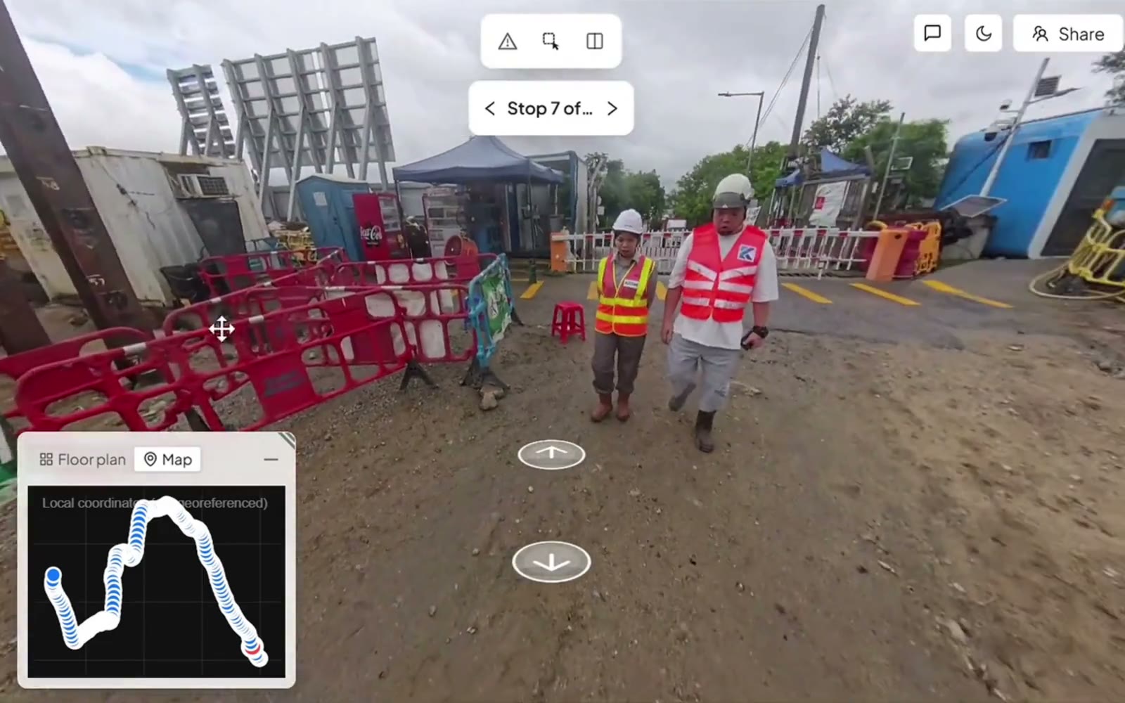
Pinning an issue to the spot in a 360° walk, in SpatialSense.
What DroneDeploy users run into, and how SpatialSense helps
If you are the one who has to get every flight and every walk onto the record before the work is covered, these are the problems DroneDeploy users describe, in plain words, with what SpatialSense does about each one.
What users report
Walks that wait for Wi-Fi, or never sync
Ground app users report walks that won’t sync unless the iPad is on Wi-Fi and the app freezing while photos upload, and a user of the older StructionSite app it grew from says long video walks were lost and had to be walked again. DroneDeploy’s own release notes for July to October 2026 list a run of upload fixes.
Reported in App Store reviews (2024–2025); upload fixes listed in DroneDeploy’s release notes
How SpatialSense handles it
Trace, the SpatialSense capture app, records with no signal at all, and you assign the walk to its survey once you are back online, so a walk is never lost because the signal dropped. 360° panoramas can also be uploaded straight from a browser.
What users report
A price that is hard to justify for basic needs
Reviewers call DroneDeploy expensive, and one construction reviewer says the yearly account needed for the measurement tools is too much for people who only need basic measurements. Its construction plans are quoted rather than priced on the website.
Reported on SoftwareFinder (2024) and on a 2023 drone podcast; stated on DroneDeploy’s pricing page
How SpatialSense handles it
SpatialSense prices per site with unlimited users, and the prices are on the pricing page. Measuring a LAS, LAZ or PLY file is free in the Lite Viewer with no account, and the 30-day trial unlocks the full platform with no card.
What DroneDeploy’s own pages say
A licence before you can even log in
DroneDeploy says the Ground app needs a trial or an active licence to log in, and an enterprise account to upload and process captures, while the one plan with a published price is a single-admin licence.
Stated in the Ground app’s App Store listing and on DroneDeploy’s pricing page
How SpatialSense handles it
Every SpatialSense plan has unlimited users, so the whole project team gets a seat, and the client opens a share link without a login. In the trial you upload 360° panoramas in the browser; Trace is set up when you book a demo.
What you are after is a site where nothing is waiting on a device: the flight, the walk and the scan of the same week in one place, so you are the one who can show the client exactly what was there before it was covered.
Is SpatialSense the right DroneDeploy alternative for you?
SpatialSense is built for construction teams who fly, walk and scan the same site and need all of it in one record the client can open. Walks are recorded with no signal, scans from any maker sit beside the flights, and you can see it on one of your own sites inside 30 days, with no card.
SpatialSense fits if
You walk sites where the signal drops. Trace records with no signal and you assign the walk once you’re back online, so a basement or a remote plot doesn’t leave a gap in the record.
Your scans come from more than one scanner. Laser scans from any maker go in as E57, LAS, LAZ, PCD or PLY, in the same project as the drone flights and walks, and fixed LiDAR stations can scan a zone every 15 to 30 minutes with nobody on site.
People outside your company need the record. Share links open without a login and can be revoked, and every plan has unlimited users, so the client and the consultants never add to the bill.
You want to try it before a sales call. The 30-day trial covers the full platform with no credit card, and support is one-to-one with a person at Kodifly, 24 hours a day.
How does SpatialSense compare with DroneDeploy?
The main difference is the files each tool will take. DroneDeploy reads laser scans as preprocessed .las files and, through BIM Compare, design models as Navisworks NWD or NWC. SpatialSense takes scans from any maker as E57, LAS, LAZ, PCD or PLY and models as IFC, including Revit models exported to IFC, all in the same project as the drone flights and walks.
SpatialSense
DroneDeploy
Drone work
Drone flights in the same project as walks and scans, on every plan
Mapping with drones from the major manufacturers
360° walks
The Trace app with an Insta360 X4 or X5 on a helmet or a car
The Ground app with listed Insta360 and Ricoh Theta cameras, with each walk mapped to the drawings by location and date
Laser scans
Scans from any maker as E57, LAS, LAZ, PCD or PLY, and fixed LiDAR stations that scan a zone every 15 to 30 minutes with nobody on site
Preprocessed .las files only, up to 5 GB on Enterprise or 30 GB on Ground Pro
BIM model
IFC models, including Revit models exported to IFC, open in the browser beside the point cloud and the 360° walks, with the model overlaid on the scan so you see the as-built next to the design
BIM Compare with Navisworks NWD or NWC files only, as a paid Enterprise add-on
Progress evidence
Any two dates side by side from one locked viewpoint, and a station-by-station PDF report from two dated walks, tied to the images
Progress AI, an add-on in early access with no published price
Issues
Pinned in the walk or scan with an owner and a due date, answered from the Konnect app, with WhatsApp alerts in the recipient’s language
Field Notes, which reach Procore as Observations only on Enterprise with an add-on
People outside the paid team
Unlimited users, and revocable share links that open without a login
A view-only link to one capture date opens without a login; project access for unpaid users needs an Enterprise invitation
Pricing and trial
Per-site pricing with unlimited users (current prices), and a 30-day trial with no credit card
A published price for a single-pilot licence, custom quotes for the Ground, Aerial and Unified plans, and a 14-day trial with no credit card
What it looks like in SpatialSense
Any two dates, side by side
Open two walks of the same spot from one locked viewpoint and see what changed between them.
Issues with an owner and a date
Pin a problem to the spot in the walk, assign it, and get the answer back from the Konnect app.
A link your client can open
Send a share link that opens in the browser without a login, and revoke it when the job is done.
Moving from DroneDeploy to SpatialSense
You can test SpatialSense on one site without changing how the rest of your projects run.
Gather the originals. Collect the scans and drone point clouds as E57, LAS or LAZ, the floor plans as PDF, DWG or DXF, and the design model as IFC, exported from Revit or another authoring tool, in place of the Navisworks files BIM Compare used.
Start the trial. The 30-day trial unlocks the full platform with every feature and needs no credit card.
Upload one site. Put its drone flights, scans, plans and model in one project and judge it against the DroneDeploy record you know.
Add your 360° walks. Upload 360° panoramas from your current camera in the browser, or book a demo and Kodifly sets up Trace, the capture app that records with an Insta360 X4 or X5 on a helmet or a car. After two dated walks you get the side-by-side view and the progress report.
Bring in the client. Invite the whole team, since users are unlimited, assign issues to an owner with a due date, and send the client a share link that opens without a login.
Frequently asked questions
What is the best alternative to DroneDeploy?
SpatialSense. It keeps drone flights, 360° walks and laser scans from any maker in one project, overlays your IFC model on the scan, writes a station-by-station progress report from two dated walks, and gives your client a share link that opens without a login. Every plan has unlimited users, and you can try the full platform on your own files for 30 days with no card details.
Who are DroneDeploy’s main competitors on construction sites?
SpatialSense competes with DroneDeploy on construction sites that are flown, walked and scanned. It keeps drone flights, 360° walks from the Trace app and laser scans from any maker in one project on every plan, opens any two dates side by side from one locked viewpoint, and has per-site pricing with unlimited users.
Is StructionSite the same as DroneDeploy?
StructionSite is now part of DroneDeploy, which bought it and sells its 360° walk product as DroneDeploy Ground, and some former StructionSite users on G2 say they preferred the old version. In SpatialSense, 360° walks are captured with the Trace app and an Insta360 X4 or X5 on a helmet or a car, and they sit in the same project as the drone flights and laser scans, so any two dates of the same spot open side by side from one locked viewpoint.
Does DroneDeploy support laser scans?
Yes, but only as preprocessed .las files, up to 5 GB on Enterprise or 30 GB on Ground Pro. SpatialSense takes laser scans from any maker as E57, LAS, LAZ, PCD or PLY files and keeps them in the same project as the drone flights and walks, and fixed LiDAR stations can scan a zone every 15 to 30 minutes with nobody on site. LAS, LAZ and PLY files also open free in the SpatialSense Lite Viewer.
Does DroneDeploy work with BIM models?
Through BIM Compare, a paid Enterprise add-on that reads Navisworks NWD or NWC files only. In SpatialSense, IFC models, including Revit models exported to IFC, open in the browser beside the point cloud and the 360° walks, with the model overlaid on the scan so you see the as-built next to the design.
How much does DroneDeploy cost?
DroneDeploy publishes a price for its Flight & Analysis licence for individual pilots, billed annually, but the Ground, Aerial and Unified plans are custom quotes, add-ons such as Progress AI and Safety AI have no published price, and the free trial lasts 14 days. SpatialSense has per-site pricing with unlimited users (current prices), a Lite Viewer that is free forever, with no account and no time limit, and a 30-day free trial that unlocks the full platform with every feature and needs no card details.
Can I keep the 360° camera we use with DroneDeploy Ground?
If it is an Insta360 X4 or X5, yes. Those are the cameras the SpatialSense Trace app uses, on a helmet or on a car.
Is there a free alternative to DroneDeploy?
SpatialSense has a 30-day free trial of the full platform that needs no card details, with drone flights, 360° walks and laser scans from any maker in one project. Its Lite Viewer is free forever with no account needed, and opens LAS, LAZ and PLY point clouds in a browser tab.
What do DroneDeploy users complain about?
In App Store reviews and on SoftwareFinder, DroneDeploy users mention walks that won’t sync without Wi-Fi, the app freezing during uploads, and a price that is hard to justify for basic measuring, and DroneDeploy says its Ground app needs a licence just to log in. SpatialSense records walks with no signal, keeps flights, walks and scans in one project, measures LAS, LAZ and PLY free in the Lite Viewer, and has unlimited users on every plan with a 30-day trial that needs no card.
See SpatialSense on your project
Every walk that waits on a device is a day of the site at risk. Start the 30-day free trial on one of your own sites today, with no credit card and unlimited users, or book a demo and Kodifly sets it up with Trace for you. Support comes from a person at Kodifly around the clock.
DroneDeploy help centre: cameras, .las upload, BIM Compare, sharing, subscriptions; read 4 November 2026
DroneDeploy: pricing and Ground product pages; read 9 November 2026
DroneDeploy Ground app and StructionSite app reviews and version history on the Apple App Store and JustUseApp; read 9 November 2026
DroneDeploy reviews on SoftwareFinder; “Your Drone Questions Answered” podcast, episode 29 show notes; read 9 November 2026
SpatialSense is not affiliated with DroneDeploy. User reports are summarised from public reviews and forum posts; product information accurate as of 9 November 2026. Verify current features and pricing with the vendor.