

A drone or laser scan of the site
The monitoring runs on a point cloud of the ground. A 360° walk alone will not do.
Site drainage and rain
Most sites find out after the storm. With a drone survey or a laser scan of your site, SpatialSense shows how water will flow across the ground, where rain will pond at each rainstorm warning level, and what changes with a temporary barrier. A 360° camera is not enough on its own, because a photo carries no ground levels.
Water on a site follows the ground, and the ground changes every week as you dig, stockpile and backfill. A drainage drawing from the start of the job does not show this week’s low spots. A fresh scan does. Point cloud monitoring in SpatialSense takes the scan of your site and shows water-flow arrows across it, the areas where rain will pond at each rainstorm warning level, and the difference a temporary barrier makes compared with no barrier. It needs a point cloud of the ground from a drone survey or a laser scanner; 360° photos alone carry no ground levels.
Drainage is planned for the finished site. The site you have this week is a different shape.
Excavations, stockpiles and haul roads move the low spots every week.
Ponding is usually found by walking the site after a storm, once the water is already where it should not be.
Sandbags and bunds go where someone thinks the water will come from.
Running the rain on this week’s scan turns drainage from something you react to into something you plan, with time to move a pump or build a bund before the forecast arrives.
The monitoring runs on a point cloud of the ground. A 360° walk alone will not do.
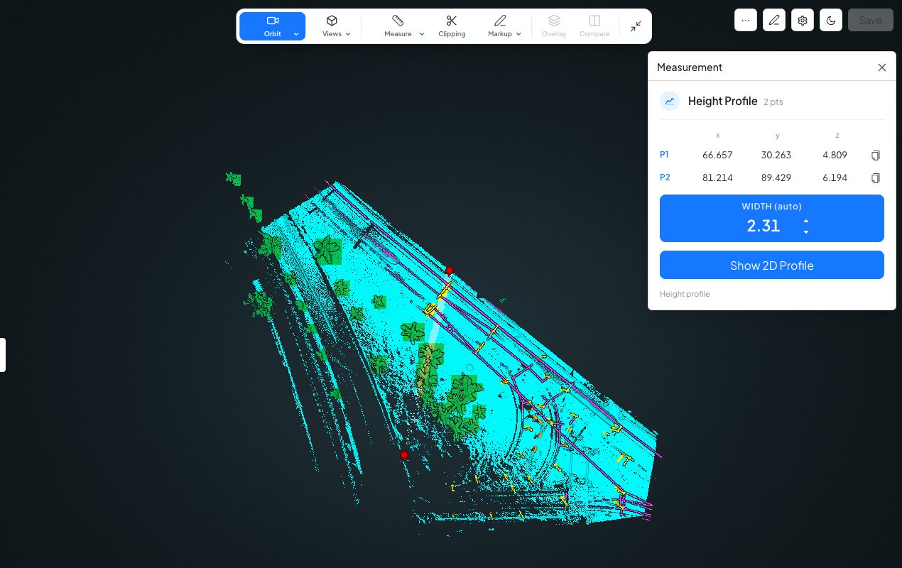
Cut a height profile across the site to see the levels along any line, as the ground is this week.
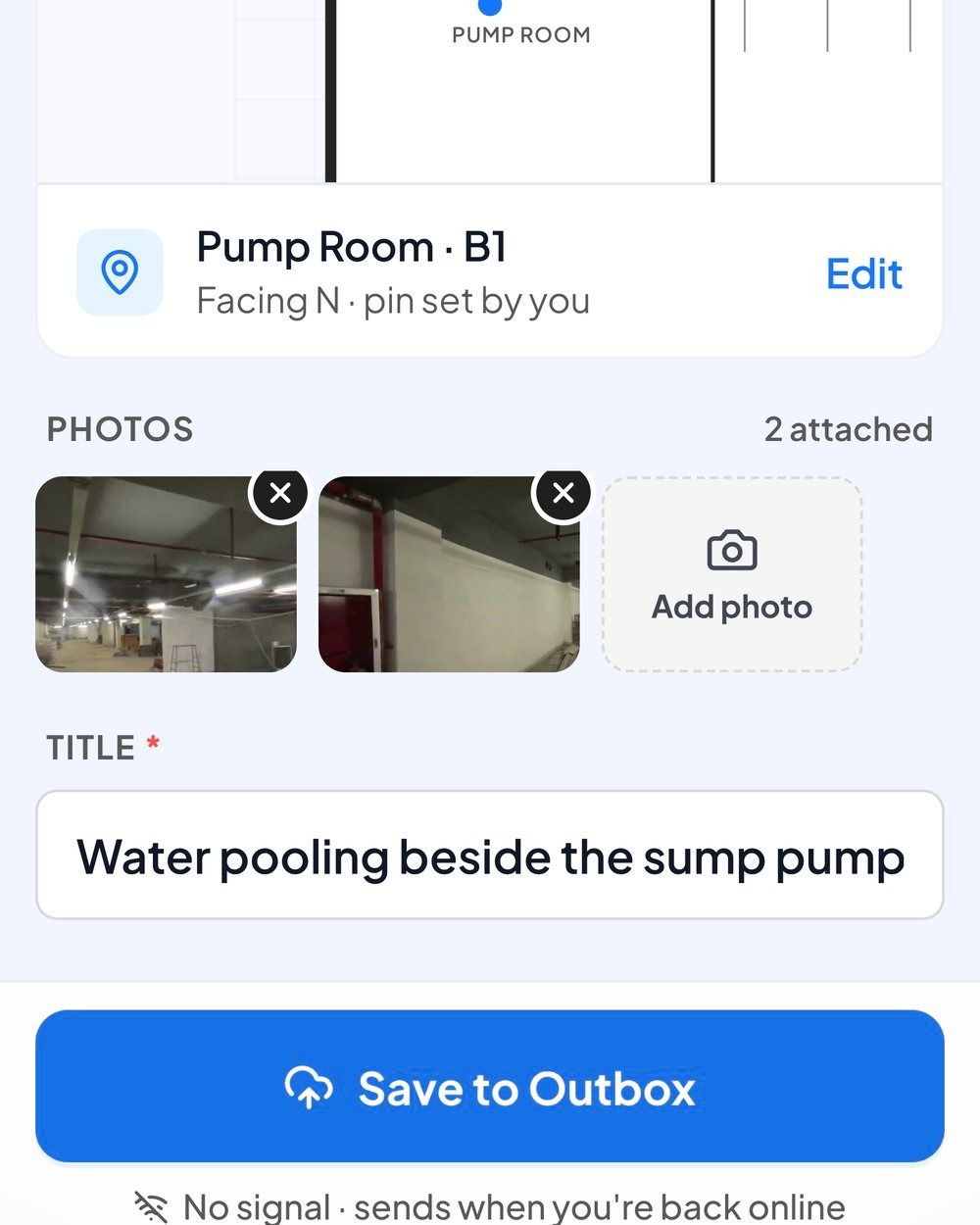
Raise the low spot as an issue from the phone, with photos and its place on the plan, even with no signal.
The same storm forecast, met two ways.
| From this week’s scan in SpatialSense | From the drawings and experience | |
|---|---|---|
| The ground it uses | The site as scanned this week. | The design levels, or memory. |
| Where water goes | Flow arrows across the scanned ground. | A judgement on site. |
| Where it ponds | At each rainstorm warning level. | Found after the storm. |
| Temporary barriers | Tested against no barrier first. | Built, then checked. |
| What happens next | An issue on the spot, with an owner and a due date. | A call or a message. |
Monitoring runs on a scan of the ground, so start with the most recent one you have.
Use a recent scan of the ground. In SpatialSense, point cloud monitoring shows how water will flow across the scanned site and where rain will pond at each rainstorm warning level.
A point cloud of the site from a drone survey or a laser scanner, as E57, LAS, LAZ, PCD or PLY. A scan from this week shows this week’s ground.
No. A 360° photo shows what the site looks like, but it carries no ground levels, so water flow cannot be worked out from it. You need a point cloud of the ground from a drone survey or a laser scanner. Your 360° walks can sit in the same project, next to the scan.
Yes. Compare a scenario with a temporary barrier against one without it, and see where the water goes in each.
No. It shows where water is likely to flow and pond on the ground you scanned, so you can plan drainage and temporary works before the rain. Keep following your site’s drainage plan and weather procedures.
Point cloud monitoring is part of the Enterprise plan, which is priced for your project. Book a demo with a recent scan of your site and we show it to you on your own ground.
Bring a recent drone or laser scan to a demo, and leave with a list of the low spots to fix before the next storm.