

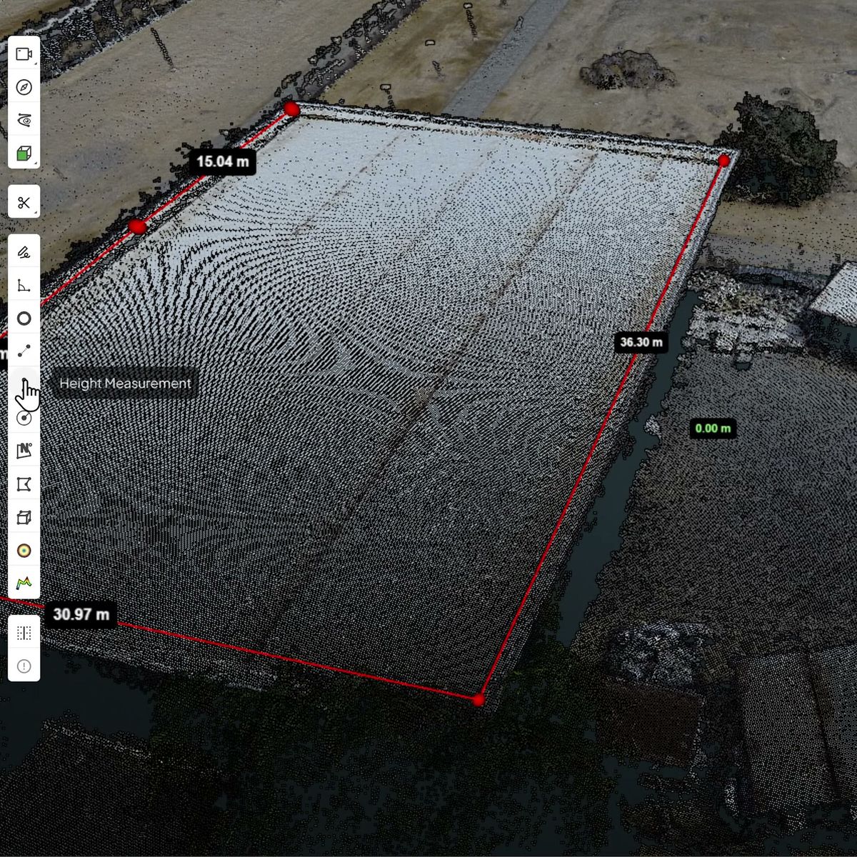
Heights and clearances
Use Height Measurement for vertical distances, such as a clearance or a wall height.
360° photos and point clouds
You can, if there is a scan behind it. A 360° photo shows what is there, but it has no depth of its own. In SpatialSense the walk sits inside the point cloud, so you look at the photo and take the measurement on the scan, in a browser.
A 360° photo is a flat picture wrapped into a sphere. It records light, not distance, so any tool that measures from the photo alone has to estimate the depth, and the result is only as good as that estimate. A point cloud has a measured position for every point. SpatialSense puts the 360° walk inside the scan: you look at the photo to see what is there, and you take the measurement on the scan.
The photo gives you context. The scan gives you the number.
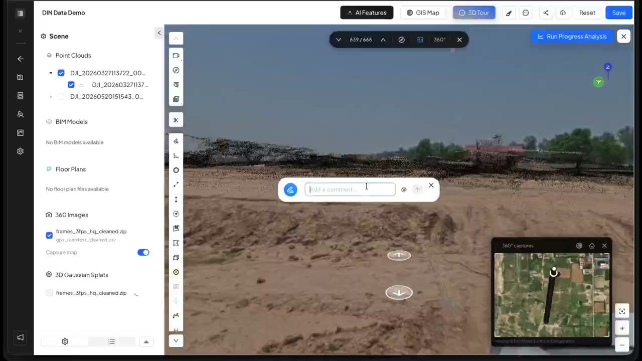
Upload the 360° walk and a point cloud to the same survey, then click a capture point to open the photo in place.
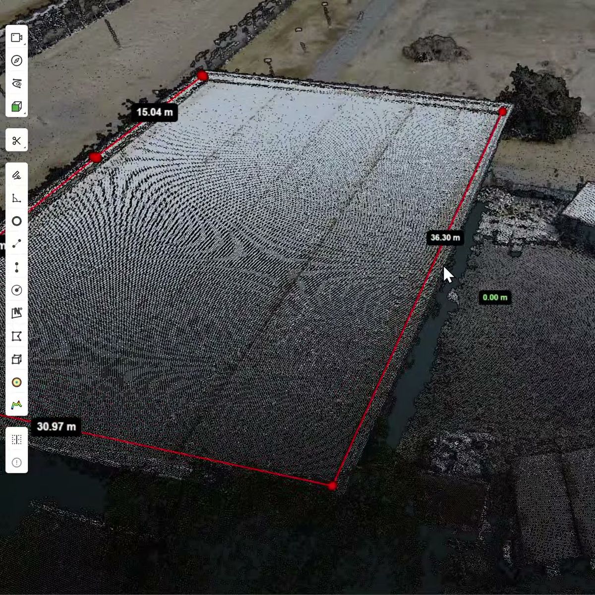
Pick Distance, Height or Area and click on the scan. Keep clicking to follow an edge.
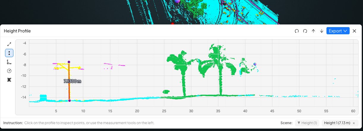
Draw a height profile across the area and measure on the 2D section, then export it.
Teams reach for photo measurements because the walk is already there. The trouble is what a photo does not contain.
A 360° camera records light, not distance. Any distance taken from the photo alone has to be worked out some other way.
Bare walls, glass, low light and long distances make depth harder to judge, and those are often the places you need to measure.
Without a scan there is no second source to tell you whether a number is close.
For a quick look, a photo is enough. For a number that goes into a claim, an order or a design check, take it on a scan.
Use Height Measurement for vertical distances, such as a clearance or a wall height.
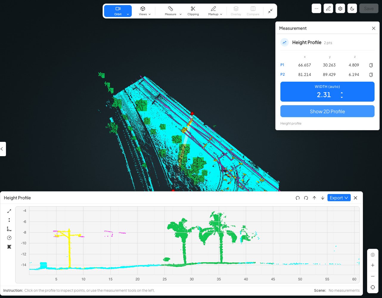
A height profile shows the ground, structures and clearances along any line you draw.
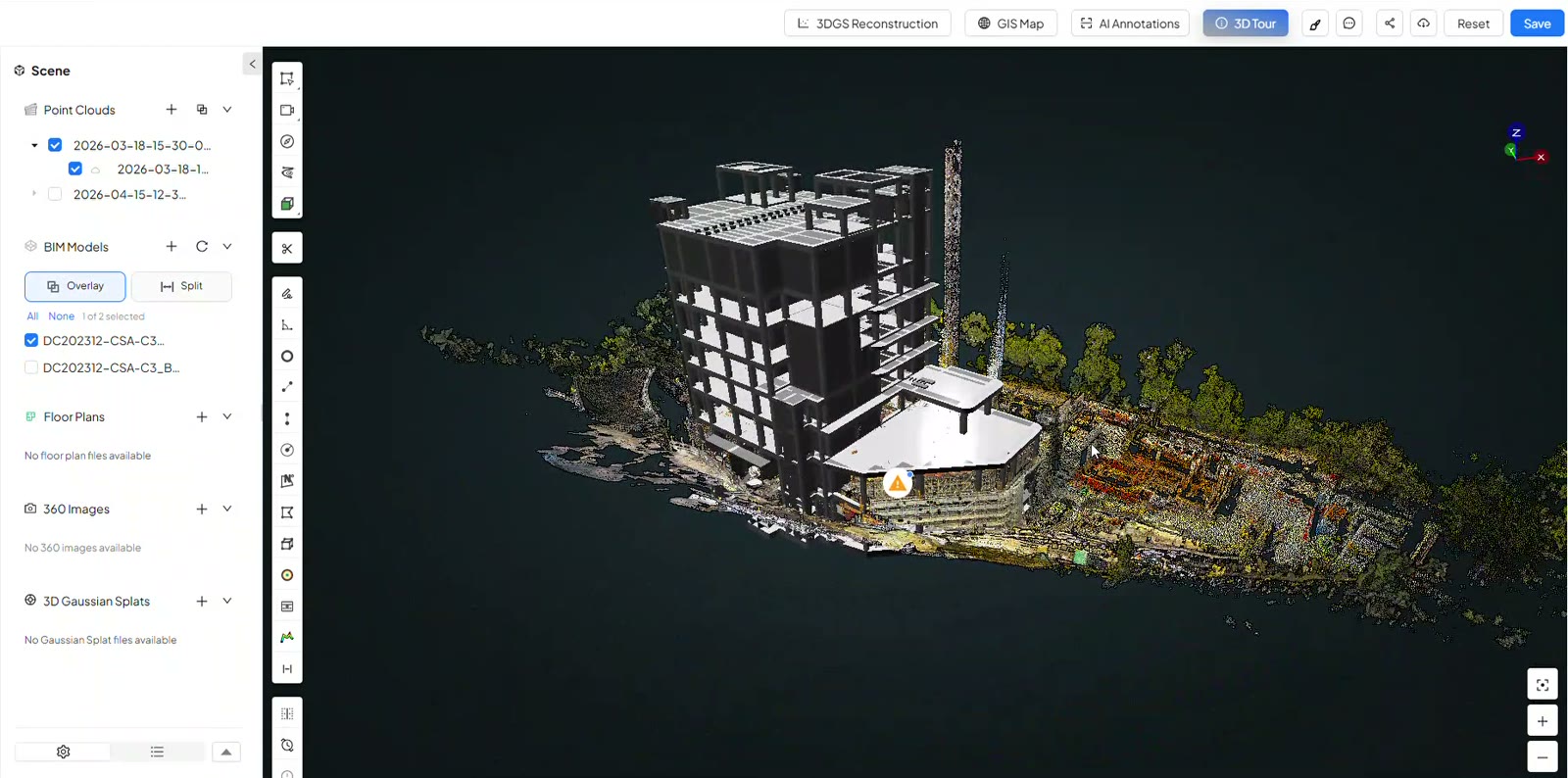
Open the whole scan and measure anywhere on it, with nothing to install.
Where the number comes from makes the difference.
| On the scan in SpatialSense | On the photo alone | |
|---|---|---|
| Where the number comes from | Points with a measured position. | An estimate of depth. |
| What you can measure | Distance, height and area, plus sections from height and width profiles. | Depends on the tool. |
| Checking a result | Take it again, or cut a section and measure on that. | Hard to check without a second source. |
| Context | The 360° photo opens in place over the scan. | The photo itself. |
| Export | Profiles export as PNG, PDF, CSV or LAS. | Depends on the tool. |
All you need is a 360° walk and a scan of the same area.
It depends on how the depth is worked out, because a 360° photo has none of its own. We do not publish an accuracy figure for photo-only measurement. In SpatialSense you measure on the point cloud instead, and a measurement there can only be as fine as the scan’s point spacing.
You need a point cloud of the area. It can come from a laser scanner of any make or from a drone flight, as E57, LAS, LAZ, PCD or PLY.
Yes. With a BIM model loaded, points on the model show in blue and points on the scan in red, and the label shows which pair you measured.
Yes. Height and width profiles export as an image (PNG), a PDF, a 2D CSV or a 3D LAS file.
Yes. Start a 30-day free trial with no card details and upload your own walk and scan. To open a single LAS, LAZ or PLY file, the Lite Viewer is free.
Put your 360° walk inside your scan, and take the measurements you can stand behind.