

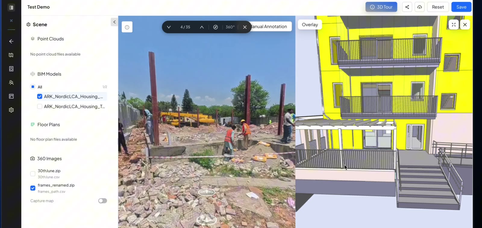
Outside, on the frame
Check the structure from the street with the model of the same elevation beside it.
360° photos and BIM
See for yourself, in one view. SpatialSense lines your 360° walk up with the BIM model in a few guided clicks, then locks the photo and the model together so turning one turns the other.
A 360° walk shows the site as it is. The BIM model shows it as designed. Putting them side by side used to mean trial-and-error alignment and two windows that never pointed the same way. In SpatialSense you line the 360° photos up with the model or the floor plan in a few guided clicks, then lock the views: turn the photo and the model turns with it, so you are always looking at the same wall, slab or opening in both.
The alignment is the hard part. SpatialSense makes it a short, guided job.
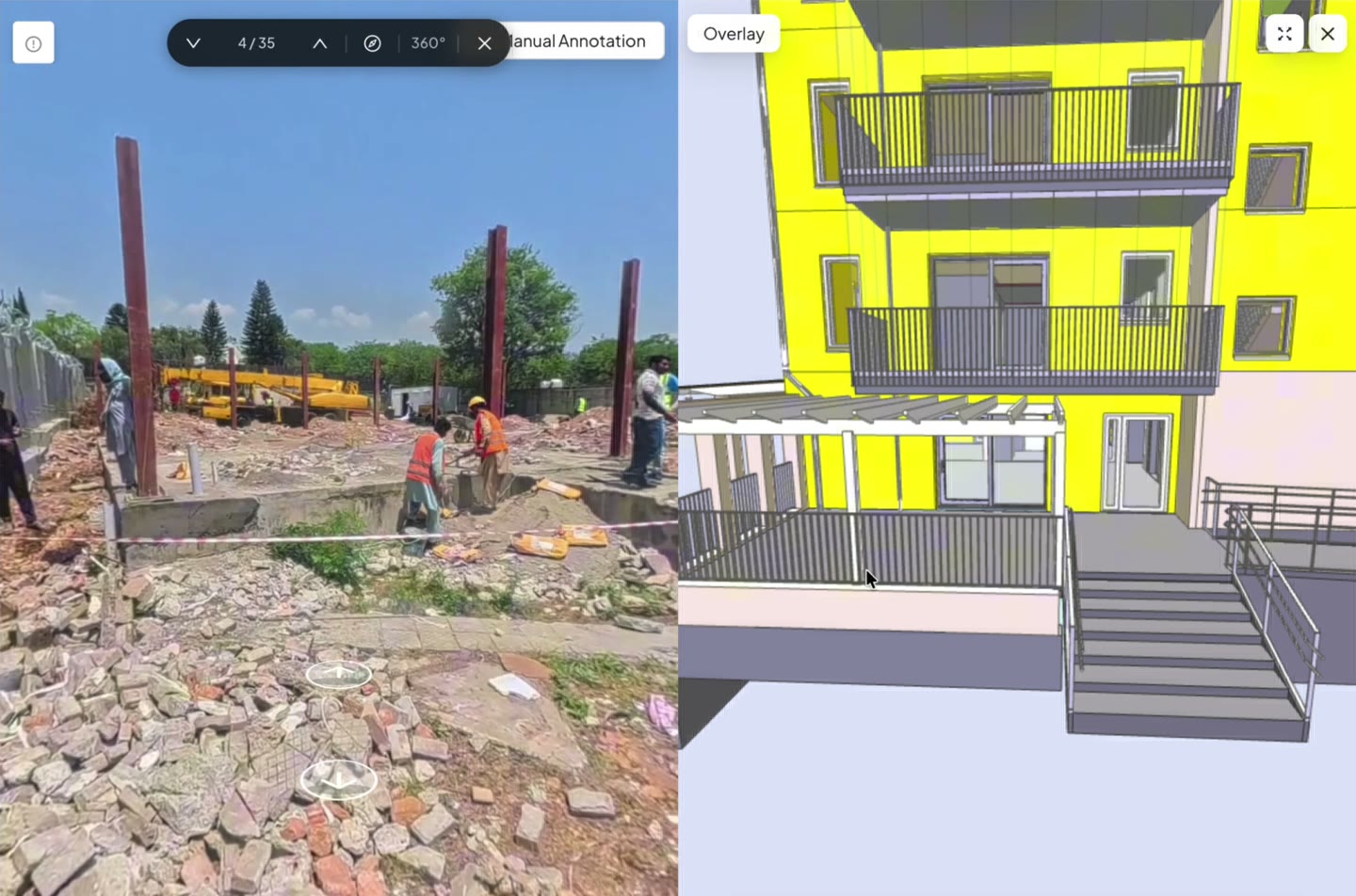
Upload the 360° walk and the IFC model to the same survey.
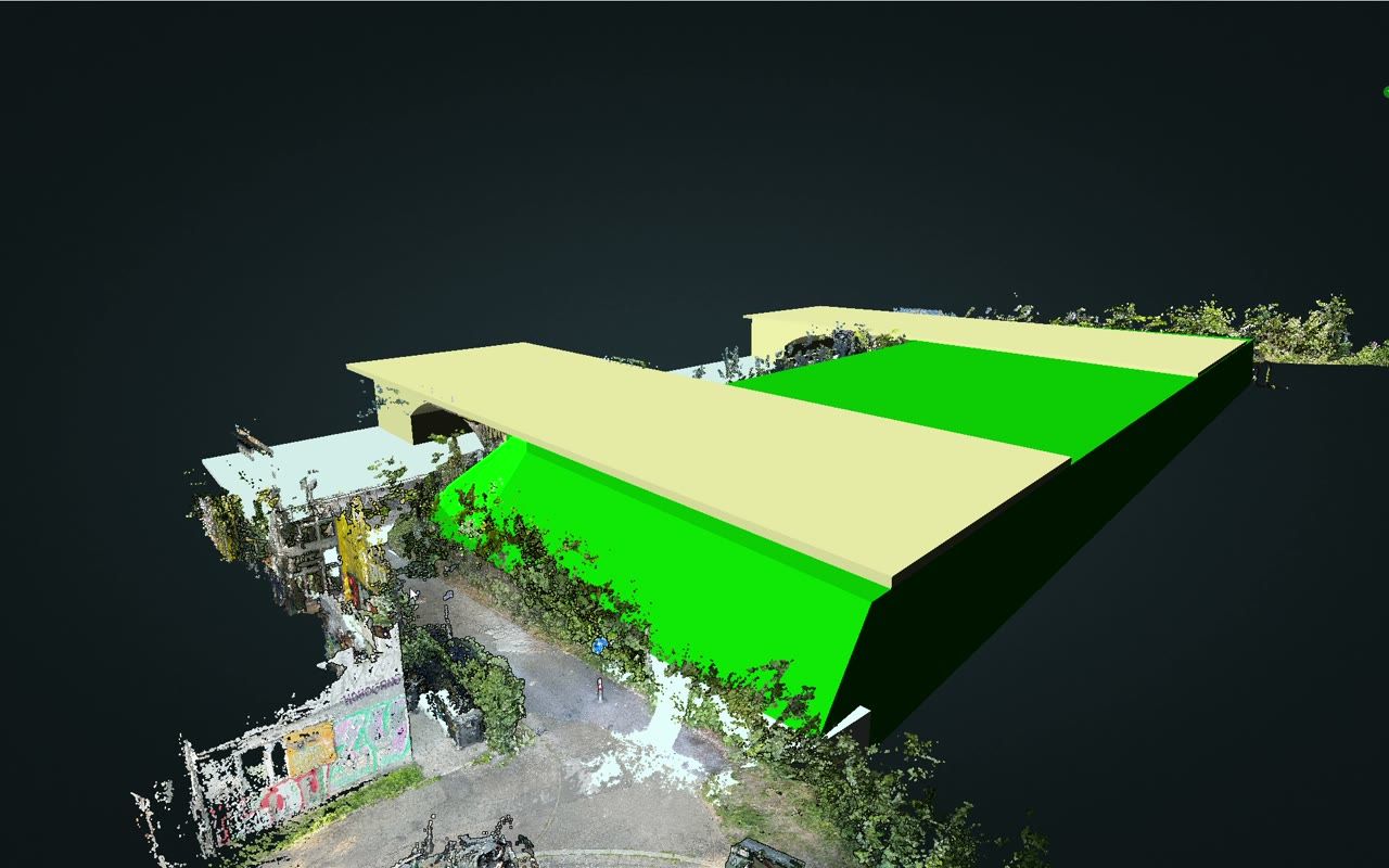
Guided alignment puts the 360° photos on the model or floor plan in a few clicks. Move a photo and it saves as you let go.
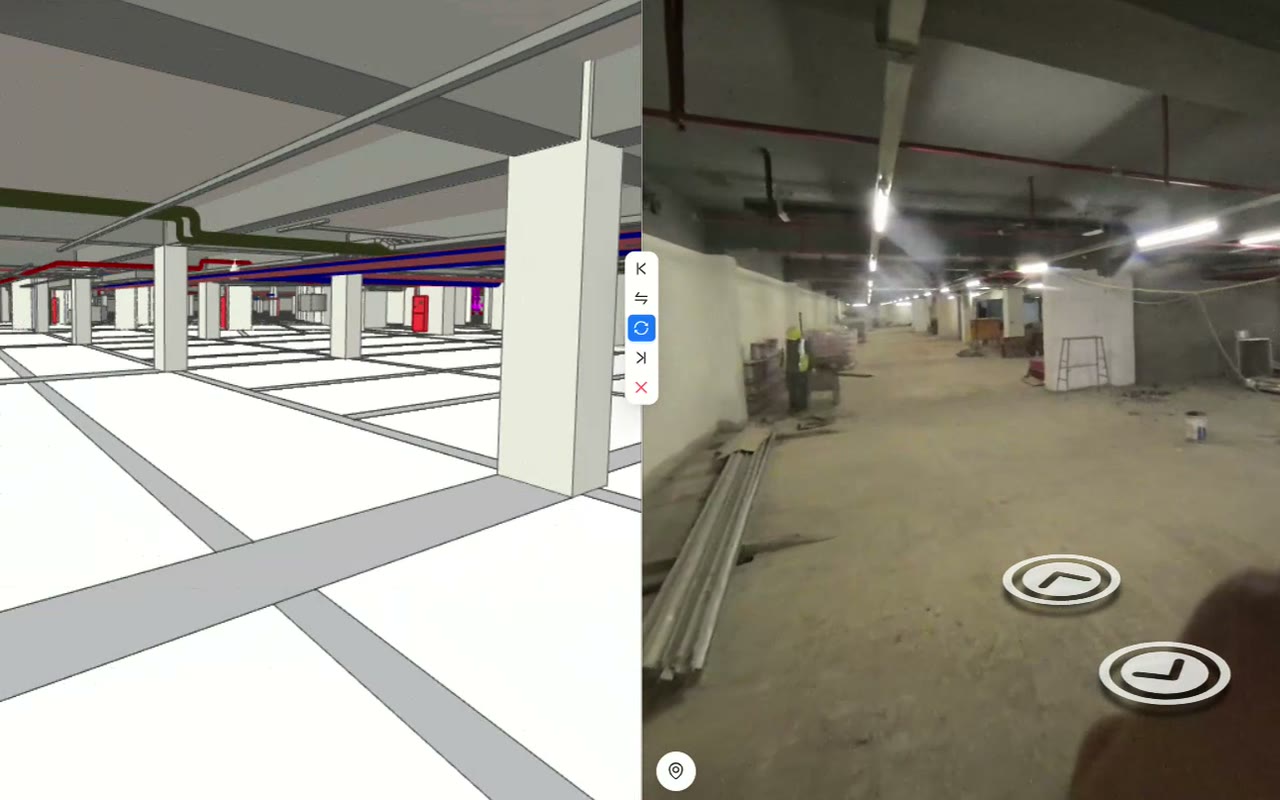
In split view, lock the 360° photo, the model and the point cloud together. Turn one and the others follow.
In reviews of 360° site tools, the comparison with the model is among the most praised features. Getting there is what takes the time.
Nudging a walk until it sits on the model can take longer than the walk itself.
With the photo in one window and the model in another, you keep turning each to match the other.
The model sits on a workstation, so the site team rarely sees it next to their walk.
Once the photo and the model line up and turn together, anyone on the project can look at both and talk about the same thing.
Check the structure from the street with the model of the same elevation beside it.
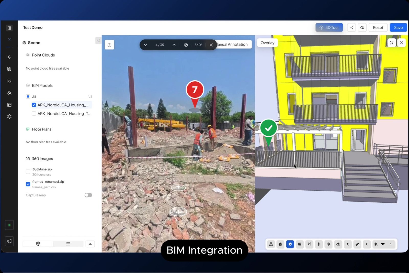
Pin an issue on the photo while the model is open beside it.
Pan around the 360° photo and the locked model view pans with it.
The same walk and the same model, looked at two ways.
| SpatialSense | Two separate windows | |
|---|---|---|
| Alignment | Guided, a few clicks, saved as you go. | By hand, by eye. |
| Looking around | Views locked together. | Turn each one to match. |
| The scan too | 360° photo, model and point cloud in one split view. | A third program. |
| Raising issues | On the photo, with an owner and a due date. | A screenshot in an email. |
| Who can see it | Unlimited users, or a link without a login. | Whoever has the model and the software. |
You need a 360° walk and the model of the same area.
Upload the 360° walk and the IFC model to the same SpatialSense survey, line the photos up with the model using the guided alignment, then open split view and lock the views so they turn together.
Upload the model as IFC. GLB models open too, and IFC and GLB files open free in the Lite Viewer.
Yes. Split view can lock the 360° photo, the BIM model and the point cloud together, so all three face the same way.
No, but it helps. The 360° photos can be aligned with the BIM model or with the floor plan, and photos show a compass and a viewing cone on the plan.
Yes. Start a 30-day free trial with no card details, and upload a walk and the model of the same area.
Line up your walk with your model, and see the site and the design in one view.