

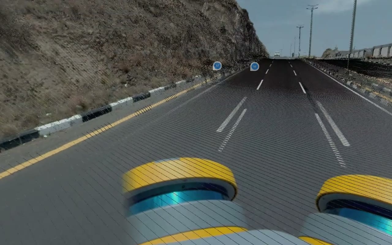
Every metre in 360°
Look in any direction from any point on the drive: the surface, the kerbs, the signs.
Roads and pavements
Mount a 360° camera on any car and drive the route. SpatialSense finds potholes and cracks in the footage, your team decides which ones are real, and the Road Condition report and pavement condition score are built only from the defects you accepted.
A road condition survey usually means a specialist vehicle or a crew walking the kerb with a clipboard. With SpatialSense, any car with a 360° camera on the roof records the road. AI road defect tracking runs over the drive and proposes each pothole and crack it finds. Your team reviews them one by one, corrects a box or a label if needed, and only the defects a person accepted go into the Road Condition report and its pavement condition score.
Trace records the drive. SpatialSense finds the defects and writes the report.
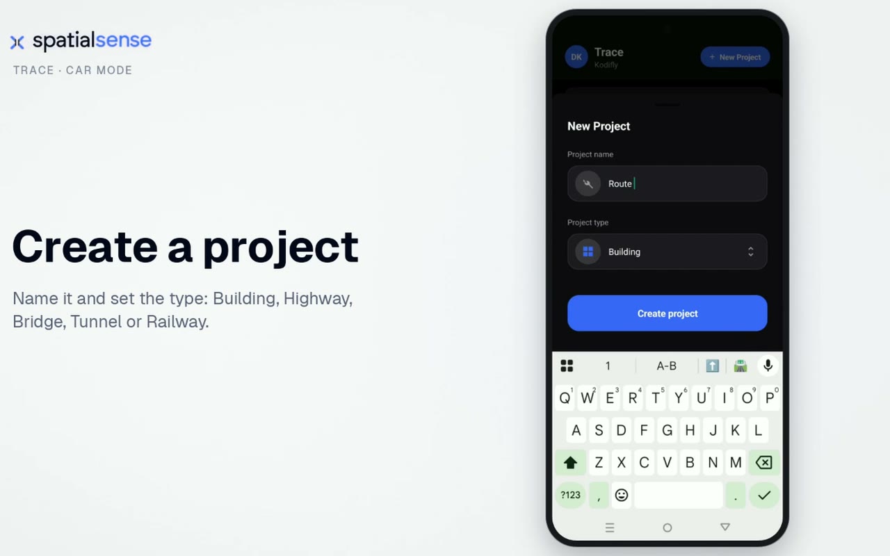
Name it and set the type in Trace. Highways, bridges, tunnels and railways are built in.
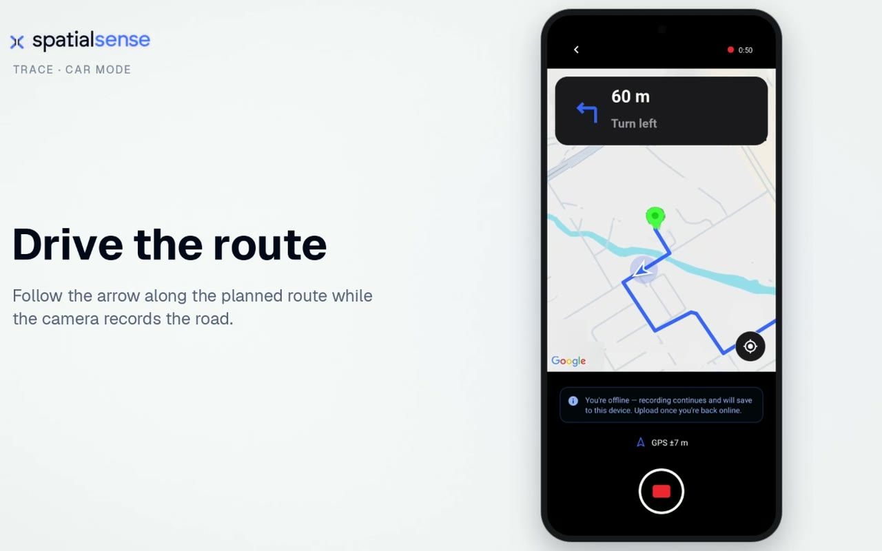
Mount the 360° camera on the car and follow the arrow along the planned route while it records.
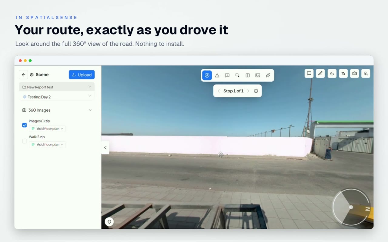
The full 360° drive opens in SpatialSense on the map, frame by frame.
Road owners want regular condition data. The way it is usually collected makes regular hard.
A dedicated survey vehicle is a big booking, so many networks are surveyed less often than their owners would like.
Walking the kerb with a form is slow, and two inspectors can score the same defect differently.
Automatic detection without a review step puts false positives in front of the client.
A car and a 360° camera can drive the route as often as you need, and a review step keeps the report to defects someone has looked at.
Look in any direction from any point on the drive: the surface, the kerbs, the signs.
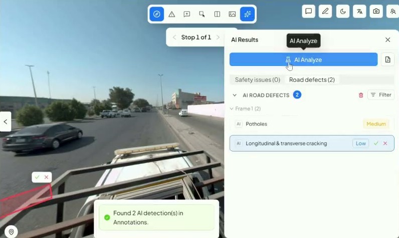
Each detection waits for a person to accept or reject it.
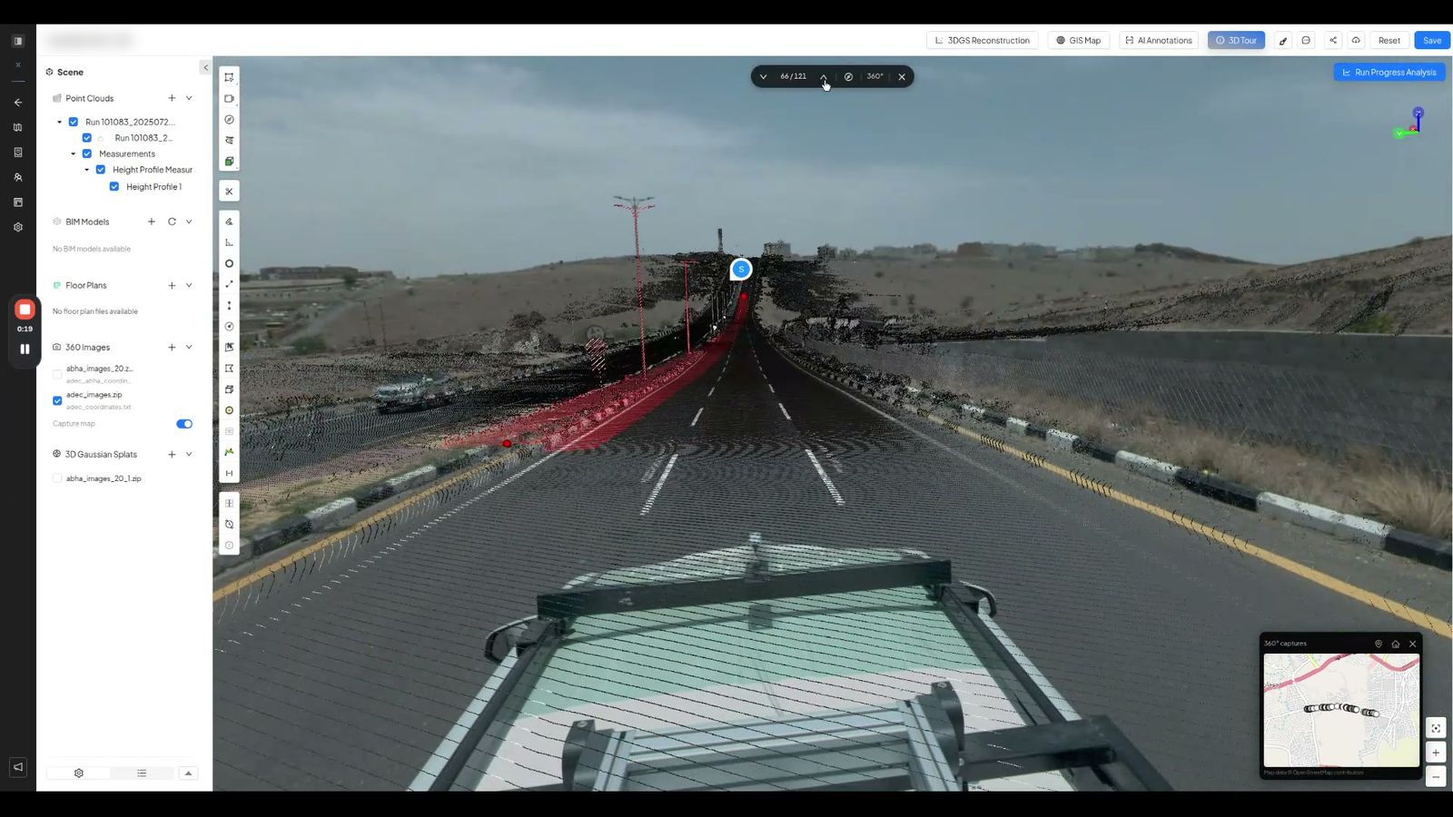
A 360° drive can sit with a scan of the same road in one project.
The same stretch of road, surveyed two ways.
| A 360° drive with SpatialSense | A manual walk-over | |
|---|---|---|
| Equipment | Any car and one 360° camera. | Inspectors on foot with forms. |
| Finding defects | AI proposes, a person accepts or rejects. | Spotted and scored by eye. |
| Evidence | The 360° frame behind every defect. | Photos when someone remembers. |
| Report | Road Condition report scored from accepted defects. | Typed up afterwards. |
| Next survey | Drive it again whenever you need to. | Book the crew again. |
Trace access is set up with you on a demo, so the first drive is right.
Yes. Mount a 360° camera on a car, record the drive with Trace Car Mode, and run AI road defect tracking in SpatialSense. Your team reviews each defect, and the Road Condition report is built from the accepted ones.
The pavement condition index (PCI) is a 0 to 100 rating of a road surface, worked out from the type, severity and amount of each defect. SpatialSense gives a pavement condition score built from the defects your team accepted; ask us on a demo how it maps to the index your authority uses.
Road defect tracking flags defects such as potholes and longitudinal and transverse cracking in the 360° frames. Every detection is a proposal until a person accepts it.
No. You can move or relabel a detection before accepting it, reject the ones that are wrong, and the report uses only accepted defects.
Trace records with the Insta360 X4 and X5. Book a demo and we help you set up the mount and the route. The platform itself has a 30-day free trial with no card details.
Book a demo, drive one of your roads, and see the defects and the score from your own footage.