Abu Dhabi Now Wants Your Signature on Each Stage of a Build. Can Your Photos Prove It?
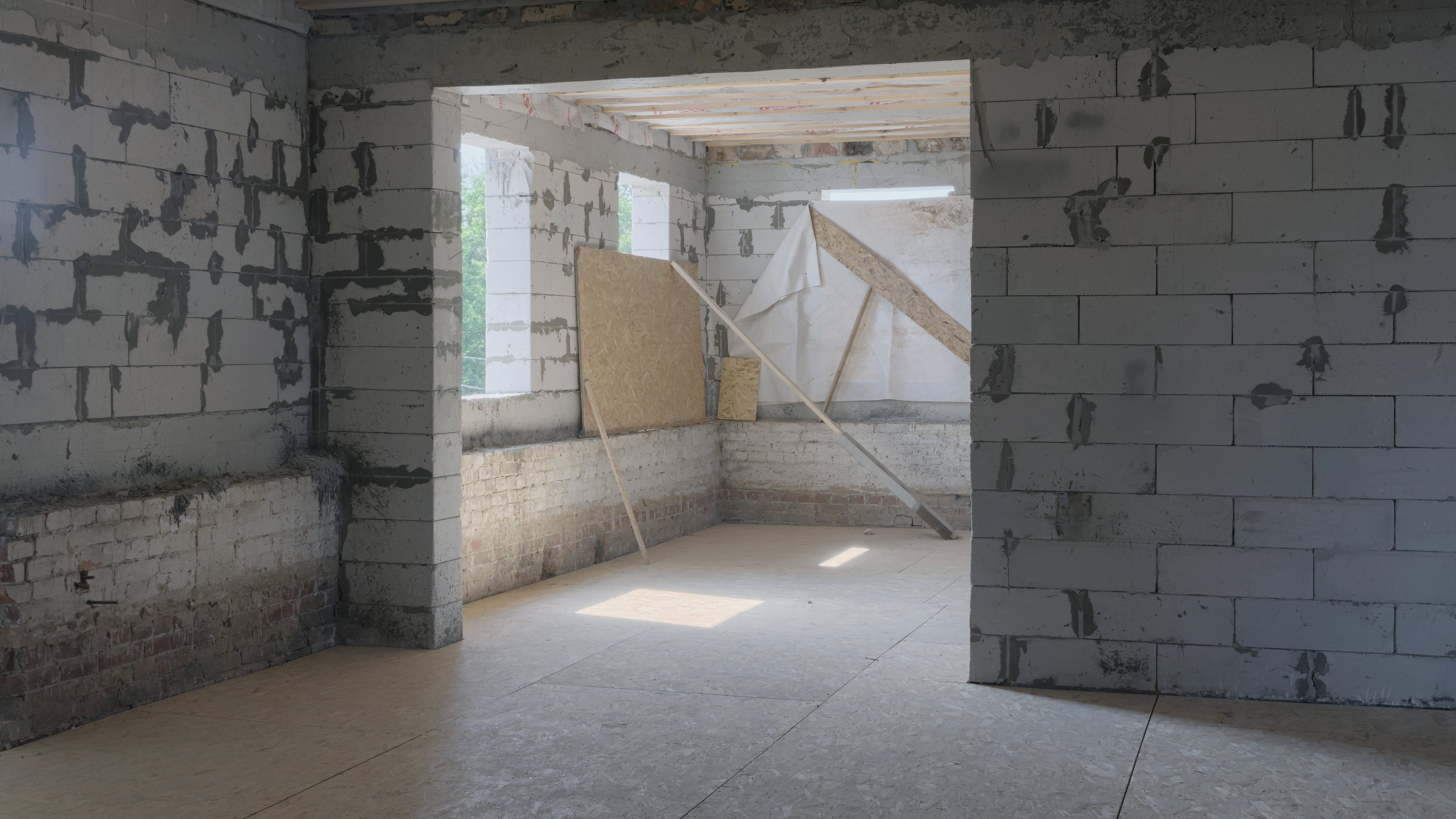

Under Abu Dhabi's Circular No. 9 of 2026, your name goes on each phase report next to the other party's, and the liability for what it says is shared. That makes the photos behind it your problem too, even when someone else picked them out of a folder on their phone and nothing in them says which bay they show or whether they were taken before the corrective work or after it.
The circular asks the contractor and the supervision consultant to close each construction phase with a certified technical report, dated and signed by both and backed by photographic evidence. You are ready for it when every photo behind that report already carries its date and its place on the plan before anyone signs, so the second signatory is checking a record instead of trusting a selection they didn't make.
The page with two names on it
Once the next phase starts, the work in those photos disappears under screed, board or backfill, and the photos become the only way anyone can check it later, including the inspectors who will keep making unannounced visits to compare reports with the site. The corners nobody thought to photograph are the ones neither signatory can answer for. The way out starts with what the circular asks for, and then with a walk routine that gives both of you the same dated record.
What Circular No. 9 of 2026 asks for
The Urban Planning and Permits Centre (UPPC) at Abu Dhabi's Department of Municipalities and Transport issued the circular on 14 October 2026, according to the Emirates News Agency (WAM), and Khaleej Times reported it the following day. It applies to all new and ongoing building projects in the emirate. Before a major phase begins, the contractor notifies the supervision consultant and documents the site conditions, and while the work goes on, the contractor documents it as it is built and the consultant checks it against the approved drawings. When the phase is complete, a certified technical report, dated and signed by both, records the executed works, the inspection results and any corrective actions, and the consultant submits it through the Unified Permitting System.
The change is meant to speed projects up, because for designated project categories the UPPC will accept that report in place of a traditional phase closure permit. WAM's announcement adds that the circular calls for photographic evidence and visual technical reports showing that the work matches the approved plans, and that the UPPC will keep making unannounced site visits to check reports against the site. Consultant and contractor are jointly liable for non-compliance, defects or non-conforming work within their own scopes, which is why the evidence matters to both of them.
We couldn't find the full text of the circular published online, so read the official version alongside your contract, and ask the UPPC whether your project is in a designated category.
Why a folder of phone photos is a weak base for a joint report
A phone photo does record a date, but that date is easy to lose once the file is forwarded, renamed or pasted into a document, and nothing in the picture says where on the plan it was taken. The Society of Construction Law's Delay and Disruption Protocol already asks for more, listing progress photographs with the date taken and, where possible, GPS coordinates among the records a project should keep.
A co-signed report also changes who has to trust the photos. When both signatories can open the same dated walk and stand at the same spot, neither of you is relying on the other's choice of pictures.
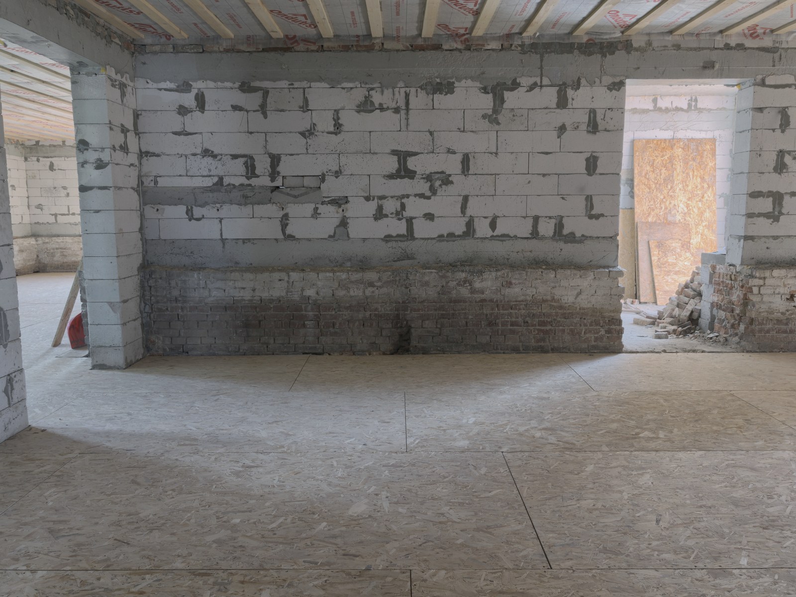 28 Sep 2026
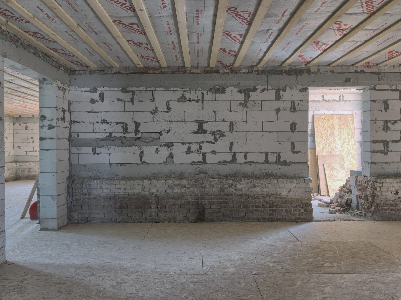 12 Oct 2026
How to build a dated, located record from site walks
The record that holds up is made on a routine, before anyone needs it, by walking the same route and capturing the same spots each time.
- Walk the area before the phase starts. The circular asks for site conditions to be documented at this point, and the walk gives both of you a starting point to compare against.
- Walk it on a fixed routine during the phase, weekly or before each pour and close-in, so that any two dates of the same spot line up. Our post on what to capture before the walls close covers the moments that matter most.
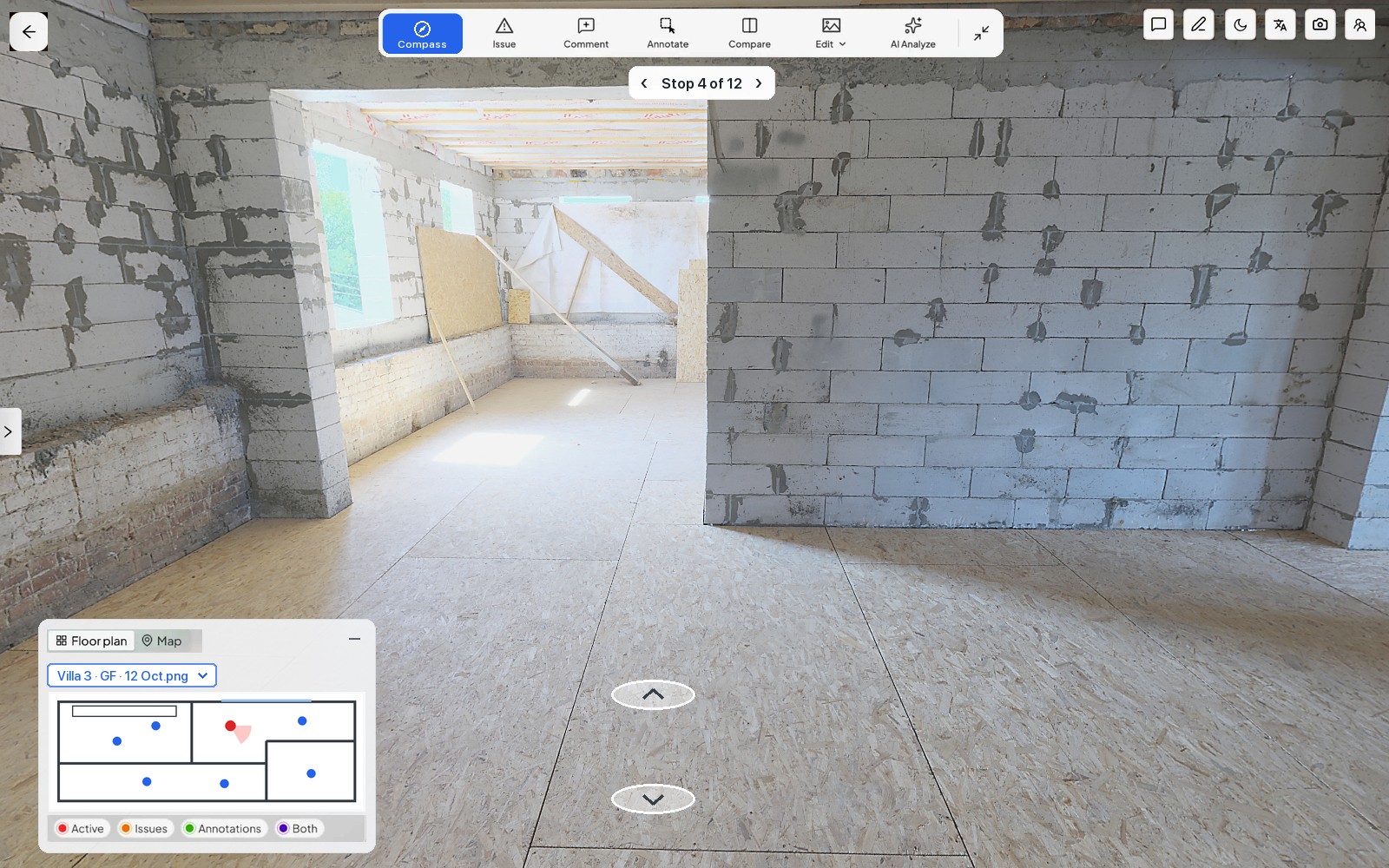
- Tie every capture to the floor plan, so each image answers "where" without a caption.
- Walk it at completion and after each corrective action, so every corrective action in the report has a before and an after.
- Review the record together before you sign, raising anything you disagree with on the spot itself while the work is still visible.
What the circular asks for, stage by stage
The middle column follows WAM's announcement; the right-hand column is our suggestion.
| Stage | What the announcement says | What to keep from your walks |
|---|---|---|
| Before a major phase | Contractor notifies the consultant and documents site conditions | A dated walk of the area before work starts |
| During the phase | Contractor documents the works; consultant checks them against approved drawings | Walks on a fixed routine, from the same spots |
| Phase complete | Report on executed works, inspections and corrective actions, dated and signed by both | A completion walk, with a before and an after for each corrective action |
| Evidence | Photographic evidence and visual technical reports showing the work matches approved plans | Images placed on the floor plan |
| After submission | Unannounced UPPC site visits to check reports | The same record, kept after the phase closes |
Where SpatialSense fits
SpatialSense keeps your 360° walks, drone flights and laser scans in one project, with each site visit stored as its own dated survey. Your team records the walk with our Trace app and a 360° camera on a helmet, and in Video Mode every frame carries GPS and a timestamp, and the walk uploads with its path drawn on your floor plan. When you and the other signatory review the phase, you can open any two dates side by side from one locked viewpoint and pin a comment or issue, with an owner and a due date, on the exact spot it concerns. A share link opens without a login and can be revoked, and every plan has unlimited users, so both teams see the same record. You can also generate a site or progress report from a survey as a PDF, and a person approves every AI finding before it reaches the report.
SpatialSense doesn't write or submit your certified technical report, and it doesn't judge whether the work conforms, because that judgement belongs to the engineers who sign. The UPPC decides what form its photographic evidence takes, so check that before you rely on any tool's export. On a small phase where one careful person photographs everything and labels each image with its date and grid line, that may be all you need, whereas a walk record earns its place when the phase is large or the work will be covered soon.
Capture. Understand. Take Action.
See SpatialSense on your project
Try it on the next phase of your own site with a 30-day free trial of the full platform, with no card needed, by uploading your 360° images in the browser, and book a demo when you want Trace set up for your team. If you get stuck, support is one to one with a person at Kodifly, 24 hours a day, 7 days a week. Start your free trial
FAQ
What is Abu Dhabi Circular No. 9 of 2026?
It is a circular the Urban Planning and Permits Centre issued on 14 October 2026, setting out the roles of supervision consultants and contractors on all new and ongoing building projects in Abu Dhabi.
Who signs the certified technical report?
The supervision consultant and the contractor both date and sign it, and the consultant submits it through the Unified Permitting System. The two of them are jointly liable for non-compliance or defects within their own scopes.
Do certified technical reports replace site inspections?
They replace the traditional phase closure permit for designated project categories, but field inspections still apply to stages that need physical checks, and so do clearances from bodies such as the Abu Dhabi Civil Defence Authority.
What photos should go with a phase report?
The announcement asks for photographic evidence showing that the work matches the approved plans, which points to images whose date and location anyone can check, taken from the start of the phase to its completion.